
A road atlas and a 1:25,000 topographic sheet can describe the same valley and still tell you almost nothing about each other's world. One tells you the pass road is signposted, surfaced and roughly forty minutes from the last town with fuel. The other tells you the ridge above it climbs 600 metres in two kilometres and that the only reliable water on the eastern side is the stream you cross at lunchtime. Neither is better. The choice comes down to what happens between leaving the car and getting back to it.
Start With the Question, Not the Map
Before comparing editions or scales, decide what the map has to do. Three questions sort out most trips within a minute:
- How will you travel for the majority of each day — car, train, foot, bike?
- How far from a surfaced road do you intend to go?
- Will anyone in the group have to make a decision on the ground, without a signpost in sight?
If the answer to the third question is no, you probably need a good road map and nothing else. If it is yes, the topographic sheet stops being optional. Most planning failures come from buying the right map for the wrong half of the journey.
What Road Maps Do Well
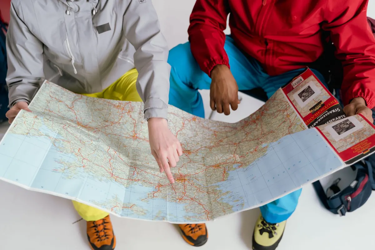
A road map is built around movement in a vehicle. It classifies roads so you can tell a motorway from a mountain lane at a glance, shows junction numbers, gives distances between towns, and marks the things a driver actually stops for: fuel, ferries, parking areas, sometimes restaurants and viewpoints. National atlases often sit around 1:200,000, while regional touring maps are frequently 1:150,000 or 1:120,000. At those scales a village is a dot and a hairpin is a kink, which is exactly the point.
Good road maps also carry distance tables and urban insets that show one-way systems, both of which save real time in an unfamiliar city. They tend to be printed on paper that folds flat on a dashboard, and many are indexed by town name rather than grid reference. Their weakness is pacing: road maps age quickly, because bypasses, junction numbers and toll arrangements change. A sheet five years old may send you through a town centre that has been rerouted since.
What Topographic Maps Add
A topographic map describes the ground itself. Relief comes through contour lines and spot heights; land cover appears as forest, scree, marsh or open farmland; water, walls, fences, buildings and boundaries are drawn precisely. Paths and tracks are shown with a distinction between the two, and in much of Europe marked long-distance routes are printed directly onto the sheet. Typical scales run from 1:25,000, the standard for walking in many countries, through 1:50,000 for general mountain use, to 1:100,000 for broad planning.
The other thing a topographic sheet gives you is a grid. That means you can describe a location precisely — to a rescue service, to a friend waiting at a trailhead, or to yourself when you are deciding whether the col ahead is the one on the map.
Reading the contour interval
The contour interval is the vertical distance between adjacent lines, and it is the single most useful number on the sheet. At 1:25,000 an interval of 10 metres is common; at 1:50,000 it is often 20 metres. A slope that shows as three tight lines on the first map may compress into one soft line on the second. Count contours before you trust a shortcut: eighty metres of ascent is a brisk twenty minutes, four hundred is a different afternoon. The same logic applies to gullies and cliff edges, which is where the coarser sheet quietly stops being honest with you.
Scale Decides More Than You Think
Scale is not a technicality; it changes what you can see and how far things feel. At 1:25,000, four centimetres equal one kilometre, so a centimetre is 250 metres on the ground. At 1:50,000 a centimetre covers 500 metres. At 1:200,000 a single centimetre stretches across two kilometres, and a village that takes ten minutes to walk through disappears entirely.
Two habits help. First, measure with a strip of paper and the printed scale bar rather than estimating by eye — finger-widths are wildly inconsistent between people. Second, translate distance into time using the terrain, not the map: six kilometres with 500 metres of ascent is a half-day for many walkers, while the same six kilometres on a flat cycle path is an hour. On a road map that six kilometres is a ten-centimetre line and no more.
Matching the Map to the Trip
Different journeys want different sheets. A rough guide:
- Long-distance driving between cities: a national road atlas at 1:200,000 with city insets, plus a phone or satnav for turn-by-turn directions at the end.
- Touring with scenic detours: a regional road map at 1:150,000, which keeps enough minor roads visible to make a spontaneous turn worthwhile.
- Day walks from a single base: one 1:25,000 topographic sheet per valley, bought locally so it reflects current paths.
- Multi-day treks: a 1:50,000 sheet for planning the whole route and a 1:25,000 sheet for the sections where navigation gets fiddly.
- Gravel and mountain biking: 1:50,000 topography that distinguishes tracks from singletrack and shows surface and gradient.
- Remote areas, even by car: a topographic sheet at 1:100,000 or 1:50,000, because minor roads, fords and long gaps between fuel stops matter more than motorway numbers.
Getting Both to Work Together
The most efficient planning uses each map for what it does best, in sequence:
- Draw the driving corridor on the road map and mark the towns where you will sleep.
- For each stop, open the topographic sheet and identify the trailheads, car parks and the junction where you leave the tarmac.
- Mark escape routes — a second path down, a road that shortens the day if weather turns.
- Note the edition date on both maps and check for anything you know has changed, especially roadworks and new bypasses.
- Check the map datum printed in the legend if you plan to transfer grid references to a GPS device; a mismatch shifts your position by hundreds of metres.
Practical details matter more than they sound. Print or buy the sheet at its true scale rather than enlarging a section on a home printer, which distorts the scale bar. Keep the topographic map in a waterproof case and the road atlas in the car door. If your group might split up, carry two copies of the sheet that covers the split point.
The Rule That Saves the Most Time
Carry the map for the slowest mode of travel you will use that day. If you are driving to a trailhead and walking from it, the topographic sheet is the one that has to be in your pocket, and the road map can stay in the glovebox. If the whole day is behind a windscreen, a detailed topographic map is weight you will never open. Buy the map for the part of the trip where a wrong turn costs something — and, when in doubt, buy both. They fold flat together.
Photo: Tima Miroshnichenko / Pexels